Francesco LA VIGNA, Corrado A.S. CAMERA, Rossella M. GAFA’, Mauro ROMA, Andrea CITRINI, Lucio MARTARELLI, Gennaro M. MONTI, Angelantonio SILVI, Valerio VITALE, Chiara FIORI, Marco MASETTI, Fabio PASCARELLA, Raffaele PROIETTI, Stefano LO FARO, Maria Pia CONGI, Marco GERARDI, Stefano TERSIGNI, Tiziana BALDONI, Simona RAMBERTI, Giuliana BARBATO, Paola MERCOGLIANO, Giovanni P. BERETTA
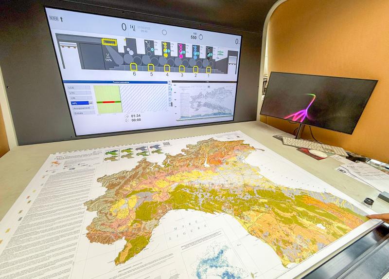
The study presents the new Hydrogeological Map of Italy (CII500K) at 1:500,000 scale, providing the first harmonized national hydrogeological framework since the official 1982 map. The product integrates regional geological and hydrogeological datasets into a unified GIS-based map describing aquifer distribution, permeability, groundwater productivity, recharge conditions, springs, piezometric trends, and major groundwater flow paths. Designed as a dynamic WebGIS platform, the map supports sustainable groundwater management, climate adaptation, and compliance with European water policies.
∇ – Methods
The map was produced through a nationwide harmonization of existing geological and hydrogeological datasets using GIS processing and a participatory workflow involving universities, regional authorities, and national institutions. Geological formations from the latest Geological Map of Italy were reclassified into 19 hydrogeological complexes according to their hydrogeological behavior and grouped into four relative permeability classes (high, medium, low, very low).
Groundwater productivity was assigned using a multi-stage methodology combining the previous 1982 hydrogeological map, the European Hydrogeological Map framework (IHME1500), Water Framework Directive groundwater bodies, expert knowledge, and ancillary information such as wells and springs. Aquifers were finally classified into six productivity classes, distinguishing porous, fractured/karst, low-productivity, and non-productive systems.
The final cartography also incorporates major cold, thermal, and coastal springs, regional groundwater flow paths, piezometric contour lines, groundwater well density, and climate indicators derived from high-resolution (~2.2 km) regional climate simulations. All products were integrated into an interactive WebGIS platform, enabling continuous updates, metadata access, and download of digital datasets.
∇ – Main results
The final product consists of four national map sheets providing a standardized characterization of Italy’s hydrogeological framework, including permeability, aquifer productivity, groundwater flow directions, springs, and recharge-related features. The accompanying WebGIS allows interactive visualization and periodic updates of the database.
Nationally, medium-permeability formations dominate (48.6%), followed by low-permeability (23.2%), high-permeability (16.9%), and very-low-permeability units (10.6%). High-productivity porous aquifers occupy 20.4% of Italy, while highly productive fractured and karst aquifers account for 14.2%, reflecting the importance of the Po Plain alluvial systems and the carbonate mountain ranges.
Strong regional contrasts emerge among Italy’s eight River Basin Districts. The Po River Basin is dominated by highly productive porous aquifers associated with extensive alluvial deposits, whereas the Southern Apennines and Sicily contain large productive fractured and karst aquifers. In contrast, Sardinia is characterized predominantly by low-productivity metamorphic and intrusive rocks. These spatial differences highlight the strong influence of geological history on groundwater availability and recharge potential across Italy.
∇ – Conclusions
The CII500K provides a modern, harmonized national hydrogeological framework that replaces the outdated 1982 reference map and establishes a common basis for groundwater assessment across Italy. By integrating geological, hydrogeological, climatic, and groundwater information within a dynamic GIS environment, it supports groundwater protection, water-resource planning, climate adaptation, and future national mapping initiatives. The open and continuously updatable database also facilitates interoperability with European standards and provides a robust foundation for numerical modelling, basin-scale analyses, and sustainable groundwater management.
∇ – Resources
La Vigna, F., Camera, C. A., Gafà, R. M., Roma, M., Citrini, A., Martarelli, L., … & Beretta, G. P. (2026). Groundwater of Italy: hydrogeological mapping at 1: 500,000 scale. Journal of Maps, 22(1), 2666964.


Leave a Reply